Drone surveying
Drone based measured survey for major retail complex roof (Copy) (Copy)
The challenge
The asset
A major retail complex in Grays required accurate roof plan drawings for upcoming maintenance and development works. The building featured a vast, multi level roof space populated with complex HVAC units, ducting, and plant equipment much of which was obscured behind high level screening and panelling.
Sending a traditional ground-based surveying team to manually map this expansive area would have taken several days, if not weeks. Navigating the maze of plant equipment on foot posed significant safety risks and would cause prolonged disruption to site operations. Furthermore, standard terrestrial laser scanners would struggle to achieve the necessary line of sight over the panelling to accurately capture the hidden assets.
The solution
How we did it
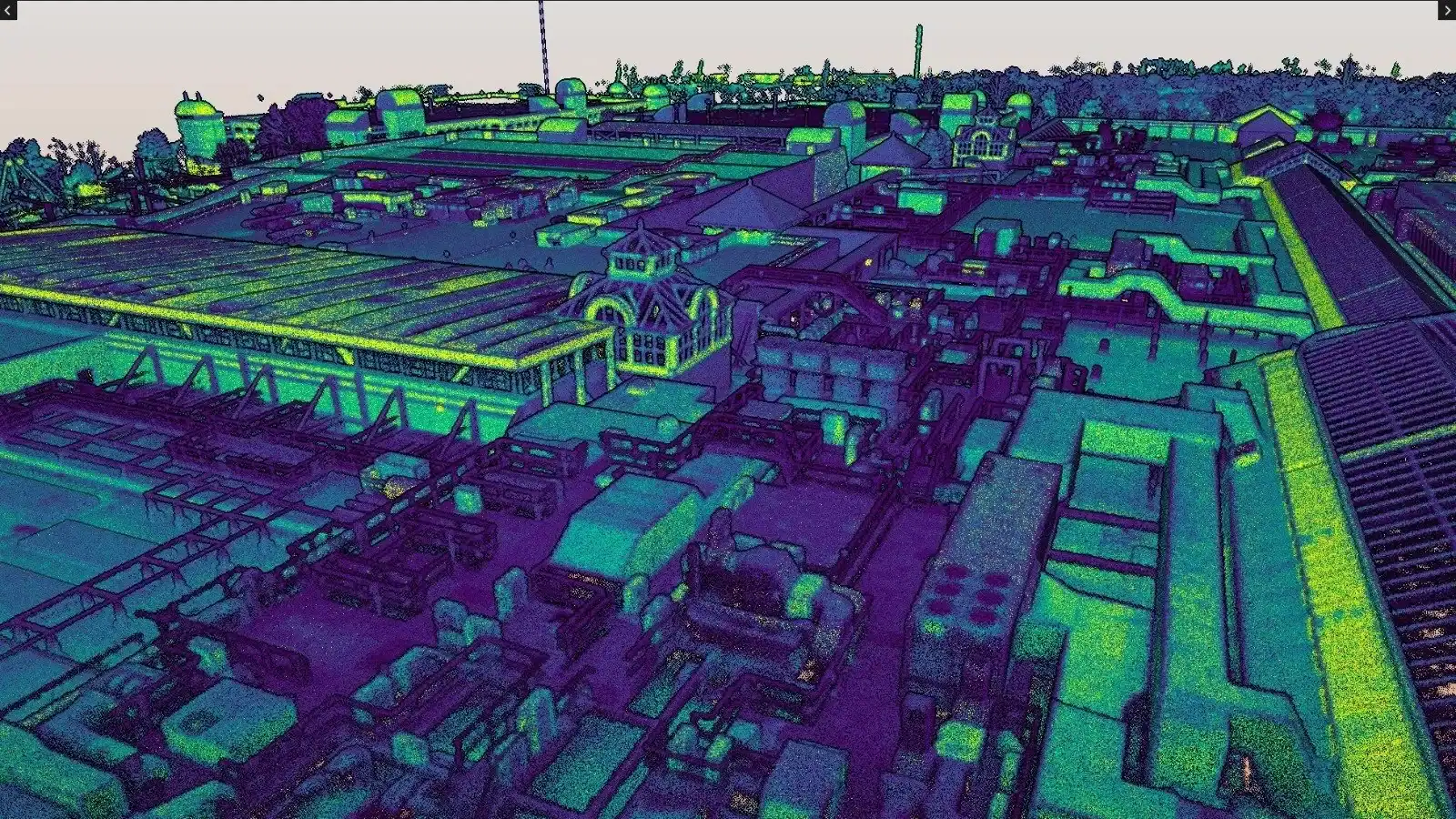
To drastically reduce time on site and capture every hidden detail from above, Vertex Air was commissioned to conduct a comprehensive drone LiDAR survey We deployed our DJI M350 RTK commercial drone equipped with the highly advanced Hovermap ST-X LiDAR payload.
Operating safely from the ground, our pilots flew systematic passes over the entire retail complex. The active LiDAR sensor easily penetrated the gaps in the roof panelling, mapping the true, hard geometry of the hidden plant equipment from an aerial vantage point. This approach bypassed the line-of-sight limitations of ground scanners and ensured absolutely no blind spots were left behind in the data.
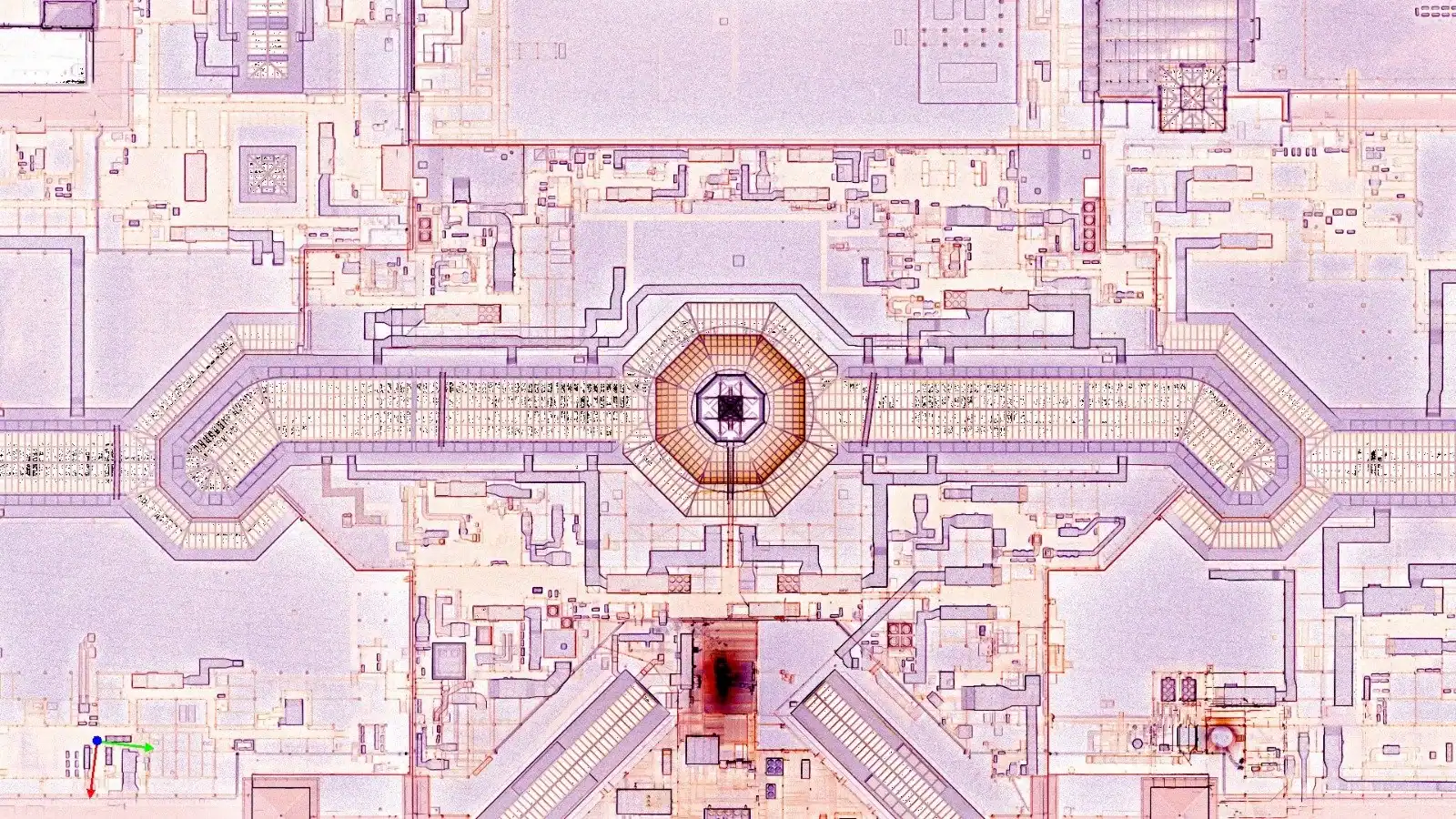
What would have taken days of hazardous manual measurement was completed safely in a fraction of the time.
Vertex Air delivered a highly accurate, fully geo-referenced 3D LiDAR point cloud of the entire roof area. This robust digital dataset was handed over to the client, enabling their engineering team to seamlessly extract precise measurements and generate flawless 2D AutoCAD roof plan drawings without ever needing to step foot on the roof.
Learn more about how Vertex Air delivers survey-grade 3D CAD data, and explore our full range of Drone LiDAR Surveys and Drone 3D Mapping.
Selected case studies
More like this
Drone based measured survey for major retail complex roof (Copy) (Copy) (Copy)
Drone based measured survey for major retail complex roof (Copy) (Copy)
Drone based measured survey for major retail complex roof (Copy)
Drone based measured survey for major retail complex roof
Urgent enquiries
Urgent site issue?
Storm damage, a loose panel or a safety concern that can't wait. Call our response line and we'll get a team moving.
Project enquiry
Start with the asset, defect or access challenge
Tell the team what you need to inspect, maintain or repair. The form is intentionally framed around commercial projects to improve lead quality.